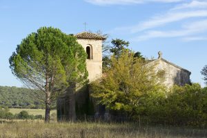
Family outing – Ampus – Notre Dame de Spéluque
Family walk – Ampus – Notre Dame de Spéluque Distance: 8 km Duration: 2h40 Difficulty: Easy Elevation: 150 m GR waymarked trail (yellow orientation arrows) You will find the car
Family walk – Ampus – Notre Dame de Spéluque Distance: 8 km Duration: 2h40 Difficulty: Easy Elevation: 150 m GR waymarked trail (yellow orientation arrows) You will find the car
Family walk – Vidauban – Le bois du Rouquan Distance : 4,1 km Duration : 2 h Difficulty: Easy Elevation: 45 m From Vidauban, go onto RD48 to La Garde Freinet
Sports hike – Draguignan – sentier du patrimoine Distance A: 6 km Distance B: 3.150 km Duration A/R: 4h Difficulty: Difficult Elevation: 450 m 1st itinerary (1) From Folletiere “wash