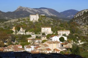
Digital walk – Draguignan – The water path
Digital walk – Draguignan – The water path Departure from rue Roumanille, behind the ATP Museum*. A mobile application allowing you to discover the old center of Draguignan as it
Park at La Tournavelle (1), between the Argens bridge, and the Ailles bridge.
From the park and go north the tarmac road for 150 m.
Go the left until to join the Tournavelle track for 1.2 km. At “Apié de Raybaud” junction follow the pathway onto your right (2).
After 500 m, leave the Tournavelle track and start “Estelles” trail (3).
Walkin a pine forest for 2 km to reach Pervanquier (4). After 1 km, you reach the Verne Valley (5).
Then Caillandres place through a forest for 1.1 km and downhill for 2 km through the Carementran Valley (6). Keep going for 1.5 km and go uphill 350 m until the Tournavelle trail.
After 250 m, leave the Tournavelle trail (3).
Take the left path downhill for 300 m to reach the Argens River. Follow the river for 900 m until back on Tournavelle trail.
Follow the tarmac road to the carpark.
Shared use trail : safe hiking during hunting season, from August to March.
Check dates on :
www.mairie-les-arcs-sur-argens.fr/associations-culture/tourisme/patrimoine.html


Digital walk – Draguignan – The water path Departure from rue Roumanille, behind the ATP Museum*. A mobile application allowing you to discover the old center of Draguignan as it

Hiking – Salernes – Saint-Barthélémy, Picaillou Distance: 6.5 km Duration: 2h Difficulty: Medium Elevation: 325 m Access: road D560, direction “Site de Saint-Barthélémy”. Carpark: Site de Saint-Barthélémy. Start at the

Family walk – Trans en Provence – Le puits aérien Distance: 5 km Duration: 1h40 Difficulty: Easy Elevation: 100 m Car park at the former railway station, on “Route du